فیلتر نتایج
نتایج 11 تا 20 از مجموع 32
Journal Paper
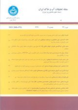
بررسی اثر تغییرات کاربری اراضی بر فرسایش خاک و تولید رسوب در حوضه رامهرمز با استفاده از طبقه بندی شیءگرا و مدل RUSLE
Authors: سعید امانپور، محمد عبیات، محمود عبیات، ماجده عبیات
Year 1400
Publish place: Iranian Journal of Soil and Water Research Issue 3، Vol 52
Pages: 15 | Language: Persian
Journal Paper
استفاده از سنجش از دور حرارتی در استخراج دمای سطح زمین و بررسی انطباق آن با الگوهای کاربری اراضی
Authors: جعفر جعفرزاده، سید محمد حسنی تبار
Year 1400
Publish place: Journal of Applications of Remote Sensing and GIS in Environmental Sciences Issue 1، Vol 1
Pages: 16 | Language: Persian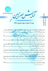
Journal Paper
پیش بینی روند تغییرات کاربری اراضی با استفاده از مدل زنجیره مارکوف (مطالعه موردی: شهرستان یاسوج)
Authors: صیاد اصغری سراسکان رود، علی اصغر اردشیر پی
Year 1399
Publish place: Town and Contry Plannig Issue 2، Vol 12
Pages: 25 | Language: Persian
Journal Paper
مقایسه الگوریتم های طبقه بندی نوع کاربری در تهیه نقشه کاربری اراضی در حوزه آبخیز زنوز چای استان آذربایجان شرقی
Authors: حمید رضا مرادی، ولی رضایی
Year 1399
Publish place: Degradation and Rehabilitation of Natural Land Issue 2، Vol 1
Pages: 9 | Language: Persian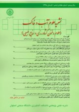
Journal Paper
ارزیابی روند تغییرات مکانی کاربری اراضی سد کارون ۳ در بازه زمانی ۱۹۹۱ تا ۲۰۱۸
Authors: مهدی پژوهش، هنگامه شکوهیده، زهرا حیدری
Year 1400
Publish place: Journal of Water and Soil Science Issue 3، Vol 25
Pages: 14 | Language: Persian
Journal Paper
Evaluation and Comparison of Different Supervised Classification Algorithms in Lands User Map Preparation Using Satellite Images (Case Study: Miandoab City)
Authors: Mehdi Mohamadpour
Year 1400
Publish place: Journal Of Radar and Optical Remote Sensing Issue 1، Vol 4
Pages: 12 | Language: English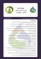
Journal Paper
بررسی تغییرات کاربری اراضی طی دو دهه دوره زمانی (مطالعه موردی: حوزه آبخیز ابوالعباس)
Authors: سیده مائده شنانی هویزه، حیدر زارعی
Year 1395
Publish place: Journal of Watershed Management Research Issue 14، Vol 7
Pages: 8 | Language: Persian
Journal Paper
ریز طبقه بندی اراضی باغی و زراعی با استفاده از تکنیکهای پردازش شی پایه والگوریتم های فازی با هدف تخمین سطح زیر کشت
Authors: بختیار فیضی زاده، علی خدمت زاده، محمدرضا نیکجو
Year 1397
Publish place: Journal of Applied Researches in Geographical Sciences Issue 48، Vol 18
Pages: 17 | Language: Persian
Journal Paper
عنوان مقاله پایش دمای سطح زمین و بررسی رابطه کاربری اراضی با دمای سطح با استفاده از تصاویر سنجنده OLI و ETM+ مطالعه موردی: (شهرستان اردبیل)
Authors: صیاد اصغری سراسکانرود، هادی امامی
Year 1398
Publish place: Journal of Applied Researches in Geographical Sciences Issue 53، Vol 19
Pages: 21 | Language: Persian
Journal Paper
پایش خشکسالی طی دوره رشد پوشش مرتعی، استان اردبیل
Authors: سعیده عینی، بهروز سبحانی
Year 1399
Publish place: Journal of Applied Researches in Geographical Sciences Issue 60، Vol 21
Pages: 19 | Language: Persian
نتایج 11 تا 20 از مجموع 32


